Non-oil company maps – North America
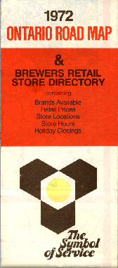
In many Canadian provinces, retail sales of alcoholic beverages (including beer) were restricted to stores operated by the provincial government. In Ontario, beer sales were made through Brewers Retail, the provincially-licensed beer retail monopoly. This unusual 1972 map was issued by Brewers Retail with cartography by Rolph-McNally. The location of each Brewers Retail "beer store" is indicated graphically on the map and in addition lists the available brands of beer and their provincially-fixed prices. Beer store locations and closing hours are listed in tabular form.
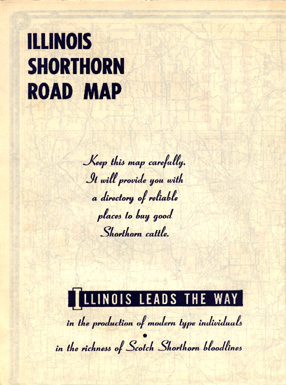
This odd map was issued by the Illinois Shorthorn Breeders' Association (ISBA) in 1950. Though the map folds to different dimensions than an ordinary road map, the unfolded map is of standard dimensions. The locations of 175 large shorthorn cattle herds owned by ISBA members are overprinted in red on the map front. On the map's rear, addresses and directions for each of these herds are listed in place of the city maps that appear on the rear of a conventional road map. The cartography for this 1950 map was done by Goushá.
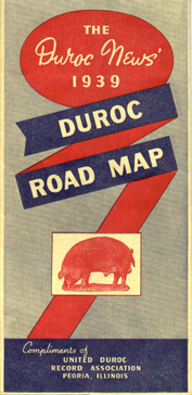
Not to be outdone by the cattlemen, the pig breeders got into the road map act. This map of the midwestern pork producing region was issued by the United Duroc Record Association of Peoria, Illinois in 1939.
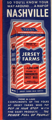
A handful of dairy companies have issued road maps. This example was issued by the Jersey Farms Milk Service of Nashville, Tennessee. This map dates from the pre-Interstate highway era. In a theme reminiscent of many oil company maps, this firm's map advertises its milk as "the power fuel of people".
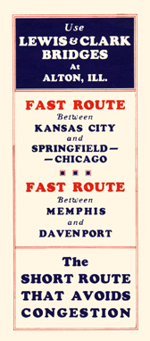
The Lewis & Clark Bridge over the Mississippi River at Alton, Illinois touted itself as a fast route that avoided the congestion of the St. Louis area and avoided railroad crossings in that busy metropolitan area. This map was published for the bridge company by Rand McNally in 1935.
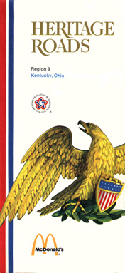
During the period leading up to the United States bicentennial in 1976, the McDonalds fast food chain published a series of road maps with historical data as well as the location of each McDonalds restaurant in the covered region.
No description