Oil company maps – North America – A
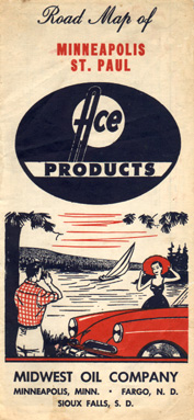
The Midwest Oil Company was based in Minneapolis, Minnesota and marketed in the upper midwest region using the Ace brand name. This Ace map was issued in 1963, shortly before the company rebranded its stations with the Midwest name.
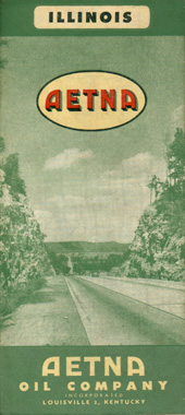
The Aetna Oil Co. was a Louisville-based company that dates to the teen years. Aetna marketed in western Kentucky and southern Indiana. This map was issued in 1946.
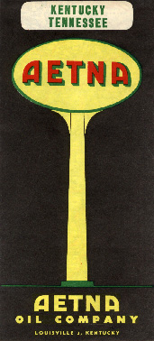
This Aetna map dates from just before the company was merged into Ashland Oil and Refining in the early Sixties.
No description
No description
Anglo was a relatively obscure brand operating in central Canada, the territory of this map's coverage probably encompassing their retailing area. Anglo-Canadian Oils Ltd. was acquired by British-American in 1963 and two years later was merged into BA subsidiary Royalite. The Anglo name began to be phased out in favor of Royalite during 1966, and the Royalite name in turn disappeared after BA and its subsidiaries became Gulf Canada in 1969. This map is undated but is believed to be from the early Sixties.
No description
The American Liberty Oil Company was founded in Texas in the Thirties. This map was issued in 1956, the year before Amlico was bought by Fina.
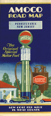
The American Oil Company was founded in Baltimore, Maryland in 1910 and marketed on the east coast under the Amoco name. During the Twenties, American built a close relationship with New Orleans-based Pan American Petroleum, which was primarily a production firm. This colorful map was issued in 1931.
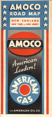
Amoco issued this colorful and patriotic map in 1933. As this map was issued, Standard Oil of Indiana was in the process of acquiring a controlling interest in the Amoco and Pan American companies.
No description
No description
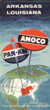
This 1957 dual-branded map was issued as the Pan-Am name was being replaced by the Amoco brand in Pan-Am's six state operating region in the mid-south.
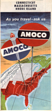
This 1959 map shows both the traditional red and black Amoco logo as well as the torch and oval logo reminiscent of that used elsewhere by parent Standard Oil of Indiana. In 1961, the new American brand was adopted by parent Standard Oil Company of Indiana for use throughout the area in which it could not operate under the Standard name. This replaced Amoco in its operating region in the mid-south and east coast, as well as the Utoco name in the west.
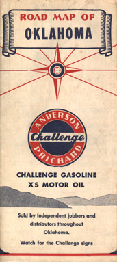
Anderson-Prichard was based in Oklahoma City, Oklahoma and marketed under the Col-Tex name beginning in the Thirties. In the late Forties, Col-Tex stations in Oklahoma were rebranded with Anderson-Prichard Challenge signs. This map dates from 1951.
No description
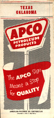
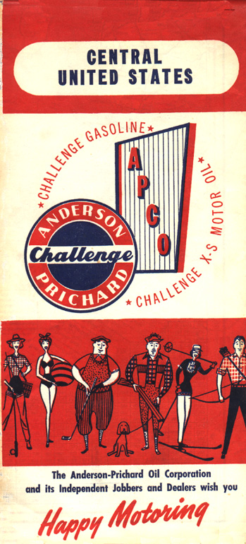
Following Anderson-Prichard's purchase of Kanotex in the early Fifties, the Anderson-Prichard and Kanotex brand names were replaced by the new Apco name. The remaining Col-Tex stations (outside Oklahoma) were sold to Cosden. Apco was acquired by Total in the late Seventies.
No description
No description
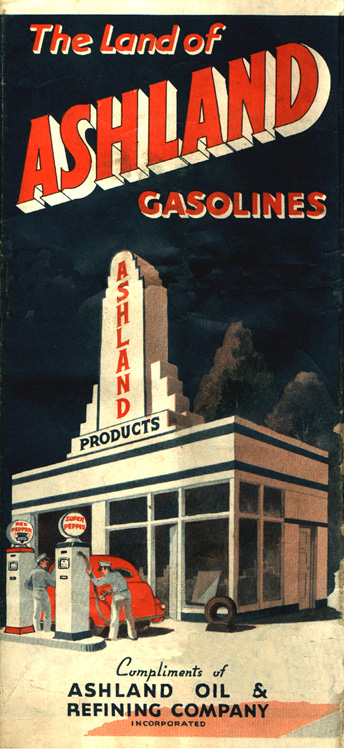
The Ashland Oil Co. is based in Ashland, Kentucky in the "chemical coast" along the Ohio River. The Ashland marketing area comprises the regions surrounding its refinery and includes Kentucky, Indiana, Ohio, West Virginia. This map dates from the early Fifties.
This is a 1961 map issued by Ashland.
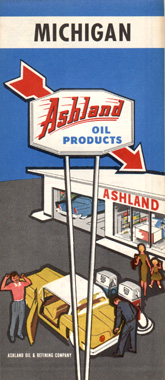
This 1967 issue shows Ashland's new logo adopted during the Sixties. Ashland has acquired a number of other regional marketers to expand its operations in recent years. In 1998 Ashland announced a merger with Marathon.
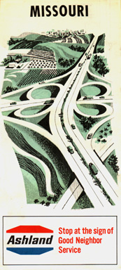
This 1967 Ashland map of Missouri uses a Rand McNally generic cover. Missouri is some distance from Ashland's principal marketing region and evidently the Missouri issue was not in sufficient demand to justify Ashland issuing a regular map of that state.

Associated was a west coast oil company that adopted the Flying A brand during the early Thirties, naming the brand after Associated's aviation-quality fuel. This map was issued in 1930 before the Flying A monicker gained prominence on the company's road maps.
In 1938, west coast-based Associated merged with east coast-based Tide Water Oil Company to form Tide Water Associated, which marketed on both coasts and parts of the midwest. This Associated map dates from 1939. During this period the Associated and Flying A names were used in the company's image.
No description
This map was issued by the Atlantic Refining Co. of Philadelphia in the late Thirties and is a nice example of the bold designs typical of the Art Deco movement from that era.
No description
No description
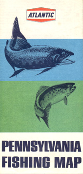
This somewhat unusual map was issued by Atlantic in 1968 to show fishing spots in Pennsylvania. Information about the variety of fish to be found in major Pennsylvania waterways is superimposed on the regular road map. The map's reverse side shows information about fishing gear instead of showing city insets as would a conventional road map.
No description